")
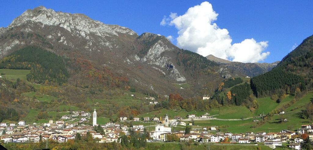
The four proposed walks, accessible to everyone and easily practicable, allow you to walk around the historic center to observe Ardesio from various panoramic points of view.
Along the paths trees, flowers and animals make up a rich heritage of biodiversity, including the possibility of observing the characteristic endemic flora. You will also be able to admire historic centres, blocks of flats, stables and huts without forgetting the frescoes and shrines, evidence of popular devotion.

Click on the map to enlarge it
Il sentiero Basso
Color: yellow – Duration: 1h
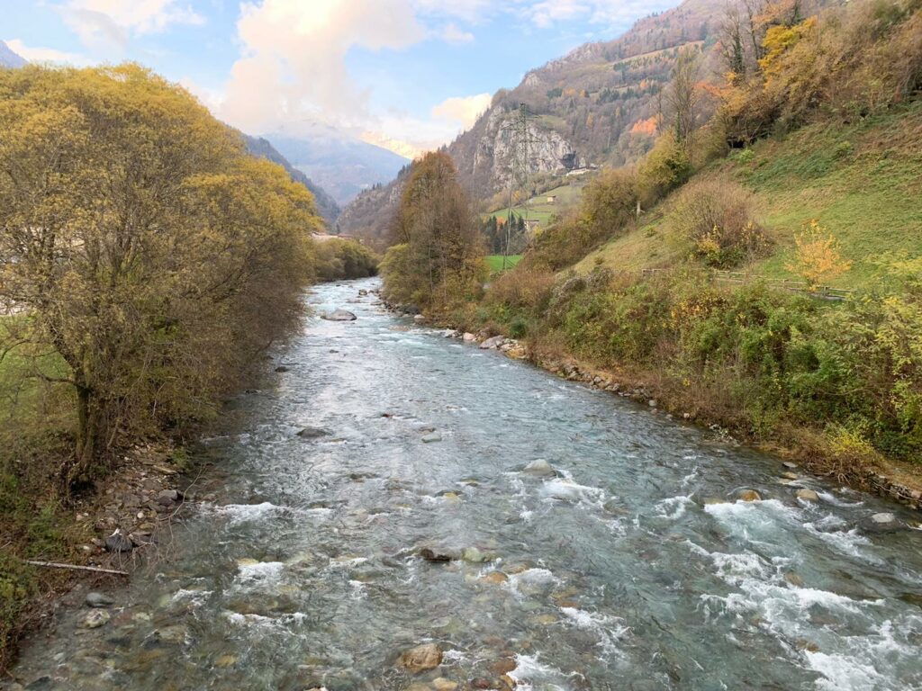
The lower path starts from the municipality of Ardesio and leads on a tour of the lower part of the town. Walking you can then admire the parish church and the church of San Pietro, until you reach the Serio river, to enjoy the walk along the river. Upon returning, back in the town you can admire the Sanctuary of the Madonna delle Grazie in the heart of the town centre.
Il sentiero Orientale
Color: green – Duration: 1h 30m
The eastern path begins in Piazza Monte Grappa, crosses the historic center and runs alongside the Sanctuary. From here, passing in front of the Casa Rural, you must climb the ancient staircase and then enter, turning right, into Balatroni. Follow the entire road until it becomes a dirt road and continue until you come across the woods and a large farmhouse (Casòt). From here begin the descent on your right: without ever taking your eyes off the historic center, you will arrive at the Plaza area
Il sentiero Occidentale
Color: blue – Duration: 1h 45m
As in the lower route, you have to go down to the Serio river, then cross the Ludrigno bridge, the access bridge to the town, turn right and, at the hydroelectric power station, cross the provincial road following the signs for Cerete.
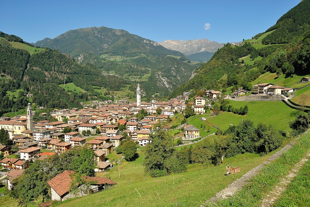
Before the hamlet of Cerete, just below the Staletti area, you will find a crossroads: take the dirt road that leads to the Alpine chapel. Continue leaving private houses, stables and barns behind you, admiring the spectacular view of the town center of Ardesio on the right. From here we understand that Ardesio is built on a natural terrace raised above the river bed. Then enter Rova and descend until you reach the second access bridge to the town: Ponte Seghe. From here you can return to the historic center by walking along the sidewalk of Via Leonardo da Vinci. Worth visiting, two hundred meters after the crossroads, on your left, is the church of S. Antonio in the Zaffalino area.
Il sentiero Alto
Color: red – Duration: 2h
Starting from the Municipality you enter the historic centre, after passing Piazza Moretto, you reach Largo A. Volta (Ponte Rino). In front of you you can see an arch, after which you reach Botto Basso. Then take the path into the magnificent forest that opens up in front of you, thus emerging on the road to Botto Alto. After a few hairpin bends and a bit of a climb, the surprising panorama of the small hamlet will certainly repay you for every effort. In the small inhabited village you can easily locate the church dedicated to S. Lucia. Not to be missed, upon entering the hamlet, is the breathtaking view of the capital: like a postcard.
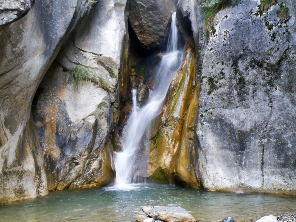
On the way back, at the first hairpin bend, take the path in the woods, thus entering the Ronchi Alti area. Then go down to Valle, where you can admire the Rino waterfall. Then continue towards Piazzolo; once you have passed the town of the hamlet, go down the municipal road which takes you back to the historic centre. During the descent you can come across the small center of Ustigno, the original nucleus of Ardesio, burned in the ancient fire.