The first inhabitants of this first alpine range were the Lighurians in the West and the Venetians in the East amongst whom came the Celtic Gauls, who progressively reduced the area previously occupied by the Etruscans (VIth century. b.C.).
We are, therefore, the descendants of the ancient Celts, who were a big influence on the territories North of the river Po, before they eventually became firmly romanized. It was up to the Roman man Marco Marcello to knock them out. In the year 179 b.C., the Celts were definitively under domination and the alpine routes were closed to any further immigration. With the fall of Imperial Rome, the dams that had been built with so much effort collapsed and the flood of barbarians broke out again violently. It seems that the first document concerning Ardesio dates back to this time period: in a document dated 15th May 409, one can read that Ardesio submitted itself to the hordes of Alaric, king of Visigoths, “with commanded delivery of weapons and men”.
In 464, the Great Danes descended with their king Bergeor. However, in Bergamo their advance was interrupted by a resounding defeat; the survivors of the massacre took refuge towards the Presolana mountains but at Pagherola, on the edge of Ardesio, they were killed by the inhabitants of the village.
On 17th August 774, Charlemagne donated a lot of land from Serio to the Benedictine Rectory of St. Martin of Tours, which included Ardesio. The influence of the Benedictine monks, who reclaimed the many uncultivated lands of the Valley, was very remarkable at this period in time.
In 1026, the bishop of Bergamo, Ambrogio, exchanged some assets “in the district of Turin, within the city of Pavia and in the district of Milan and the provost of St. Martin of Tours gave him in exchange all the assets that belonged by right to the canonical right found in Val Seriana, in Bondione, Gandellino, Ardesio, Clusone, Gromo and in other places”.
Afterwards, bishop Arnolfo got the possession of Ardesio’s silver mines, which had already been acquired in 1077 by Gandolfo from Milan from the widow of Alberico da Martinengo.
In 1156, in the full Roman Germanic Empire, Federico Barbarossa gave the districts of Seriana Valley and Brembana to Bergamo’s bishop. And it was in this period that the power of the bishop exercised a high fiscal policy towards our territories. He gave the territory of Ardesio as a fief to Oberto of Vimercate, but the populations opposed this move and showed resistance, which ended in 1179, when bishop Guala gave back all the assets to the people except for the silver mines and the forest Campello.
After the victory of the Municipalities against Barbarossa, unprecedented harshness reached the struggle between Guelphs and Ghibellines in some villages of the valley and there were certain moments of exasperated passion. Friar preachers of concord presented themselves as mediators. It was up to Bernardino of Siena to be successful: it is said that he passed through our districts in the early XVth century. In 1426 Venice expanded its territory, conquered Brescia and Bergamo and extended itself until Adda. A year before, Ardesio was given spontaneously to Venice.
The Republic confirmed the privileges and the taxes already in force and divided the territory in two “Squares”, the square of Ardesio and that of Clusone. It was a very long period lived in the shadow of Serenissima, which benefitted our land but this was not without its burdens. In a document of Francesco Donato of 1551, we have news that the soldiers of Ardesio lined up with the Venetian troops to defend the island of Candia against the Turkish invasions.
Everything lasted until 1797, when in Bergamo the napoleonic troops sent away the last rector of Venice. There were, of course, hostile protests in Seriana Valley against the new arrivals, but the latter reacted with unprecedented hardness. At Clusone “the tree of freedom” was raised, which Luigi Bana, a 28 year old lumberjack of Ardesio, had the courage to cut down. This courageous gesture was paid with his life. We were now in full economic decline, which extended itself even after 1814, when the French government was replaced by the Austrian one. However, the resurgence was already happening.
The Territory
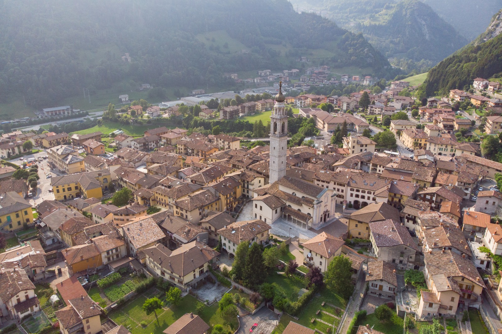
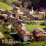
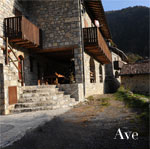
The Municipality of Ardesio has a surface area of 53,76 Km², all of it mountaneous and for this reason it forms part of the Superior Mountain Community of Seriana Valley. The capital rises to 596 m at sea level, whereas its districts and its hamlets range from 530 m from Valzella at 1.100 m to Ave. There are 3,638 inhabitants living on this territory (date 2008), which make it the capital of Valle del Serio and the second municipality, after Clusone, for the number of residents.
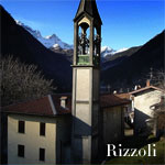
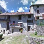
Ardesio, the capital, with its 2,500 inhabitants, represents the central nucleus from the administrative, economic and historical point of view.
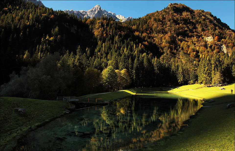
The capital lies on the left bank of the river Serio, on a river terrace surrounded by mountains which get higher gradually, leaving space for vaste meadows, rich and extended forests and pastures. The Municipality is crossed horizontally by Serio, a rich river with waters that are still clear. In the latitudinal sense, on the East, there is the valley of the Rino stream, which originates from the slopes of Mount Timogno, cuts the “Curt” cliff, and crosses Ardesio before throwing itself into Serio.
On the West, the Acqualina stream, which comes from the little mountain lake of Branchino, flows North of the mountain axis of Mount Secco and of Mount Arera, creating environmental glimpses of rare beauty, especially in those places where the thick fir forests seem to rise from the same waters. Even Acqualina flows into Serio.
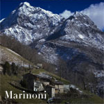
The Ardesio basin is dominated from the West by Mount Secco (m. 2.266) and from the top by Mount Vaccaro (m. 1.957). The “dolomite” ridge starts from here, which crosses the tops of Fop and Valmora and reaches up to Pizzo Arera.
From the other side of Serio, Mount Redondo (m. 1.800) rises up, and from the pasture of Vodala rises the mountain that leads to the top of Mount Timogno (m. 2.163). Therefore, one descends to the South encircling the Rino valley across pastures of Remescler, from Spigla, of Colle Palazzo until the crest of Crna Rossa, which closes the mountainous amphitheatre at the top of the capital.
Divisions and local hamlets
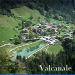
Valcanale
Situated at an altitude of 987 metres, Valcanale is the most important and populated part of the Municipality in terms of inhabitants but also in terms of its territorial configuration. Immersed in greenery and in nature with beautiful landscapes typical of alpine scenery, this makes it into one of the prestigious gems of the Orobic corollary.
Valcanale is a parish and is equipped with numerous services, including, the public line transport service. Besides this, it is also noteworthy of having its own touristic Winter sports facilities –which, in the past, have spurred on development and life.
Rich in environmental beauty, Valcanale remains a popular tourist destination. On its territory, there is the alpine mountain hut of Alpe Corte, one of the huts situated at the lowest altitudes (m. 1.410); the “Orobie Trail” starts here.
For further Information